Release Point Geographic Coordinates
You may view the release point geographic coordinates associated with a single release point from the Release Point Geographic Coordinates accordion. This section describes the process for viewing, editing, or deleting Geographic Coordinates associated with a single facility site for both Fugitive and Stack Release Points. As a reminder, Release Point Geographic Coordinates are added when a Release Point is added. They cannot be added on their own.
Facility Site Geographic Coordinates
The data table within the Release Point accordion provides information about the coordinates for the facility, whether it is a Fugitive or Stack Release Point. For Fugitive 2D Release Points, the Geographic Coordinates will display a section for Midpoint 1 and Midpoint 2 coordinates. The following fields are displayed for all geographic coordinates for Release Points.
| Column Name | Description |
|---|---|
| Latitude | The measure of the angular distance on a meridian north or south of the equator. |
| Longitude | The measure of the angular distance on a meridian east or west of the prime meridian. |
| Coordinate Tolerance | Numeric value defining the difference release point coordinate value can deviate from the facility coordinate values. |
| Source Map Scale Number | The number that represents the proportional distance on the ground for one unit of measure on the map or photo. The horizontal measure, in meters, of the relative accuracy of the latitude and longitude coordinates (in meters). |
| Horizontal Accuracy Measure (m) | The horizontal measure, in meters, of the relative accuracy of the latitude and longitude coordinates (in meters). |
| Horizontal Collection Method | The code that identifies the method used to determine the latitude and longitude coordinates for a point on the earth. |
| Horizontal Reference Datum | The code and description that represents the reference datum used in determining latitude and longitude coordinates. |
| Geographic Reference Point | The code and description that represents the place for which geographic coordinates were established. |
| Data Collection Date | The calendar date when data were collected. |
| EIS Comment | The text that provides additional information about the geographic coordinates. |
| Vertical Measure (m) | The measure of elevation (i.e., the altitude), above or below a reference datum (in meters). |
| Vertical Collection Method | The code and description that identify the method used to collect the vertical measure (i.e., the altitude) of a reference point. |
| Vertical Reference Datum | The code and description that represents the reference datum used to determine the vertical measure (i.e., the altitude). |
| Verification Method | The code that represents the methods used to verify latitude and longitude coordinates. |
| Coordinates Data Source | The code that represents the party responsible for providing the latitude and longitude coordinates. |
| Geometric Type | The code that represents the geometric entity represented by one point or a sequence of latitude and longitude points. |
| Last updated from | The person who made the last change |
| Last updated agency | The agency to which the “Last Updated By” person is associated. |
| Last updated on | Date the information was last updated. |
Viewing Release Point Geographic Coordinate Details
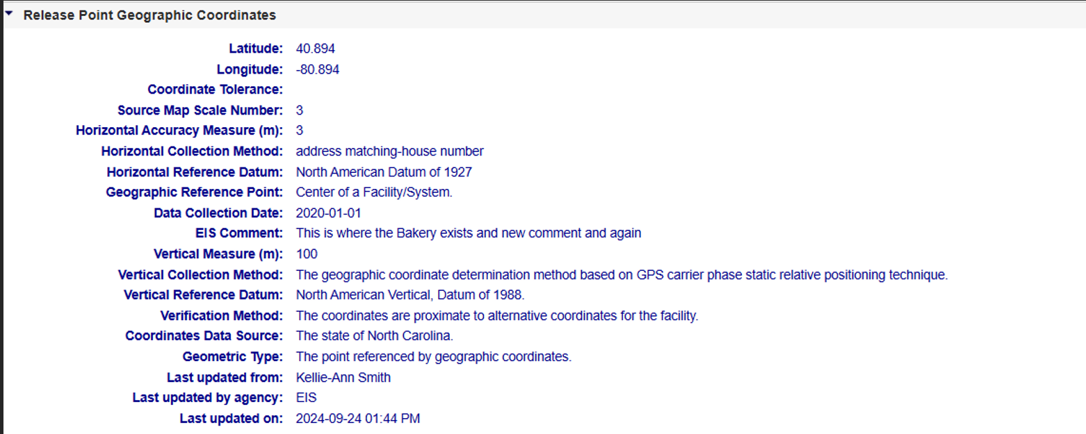
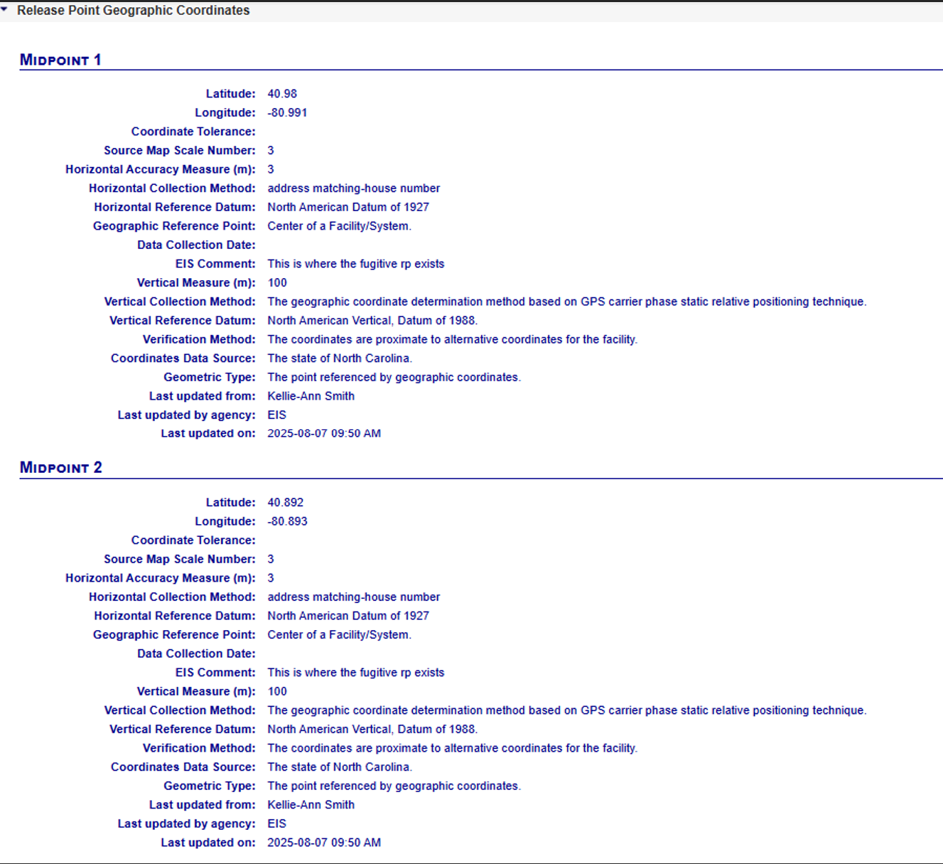
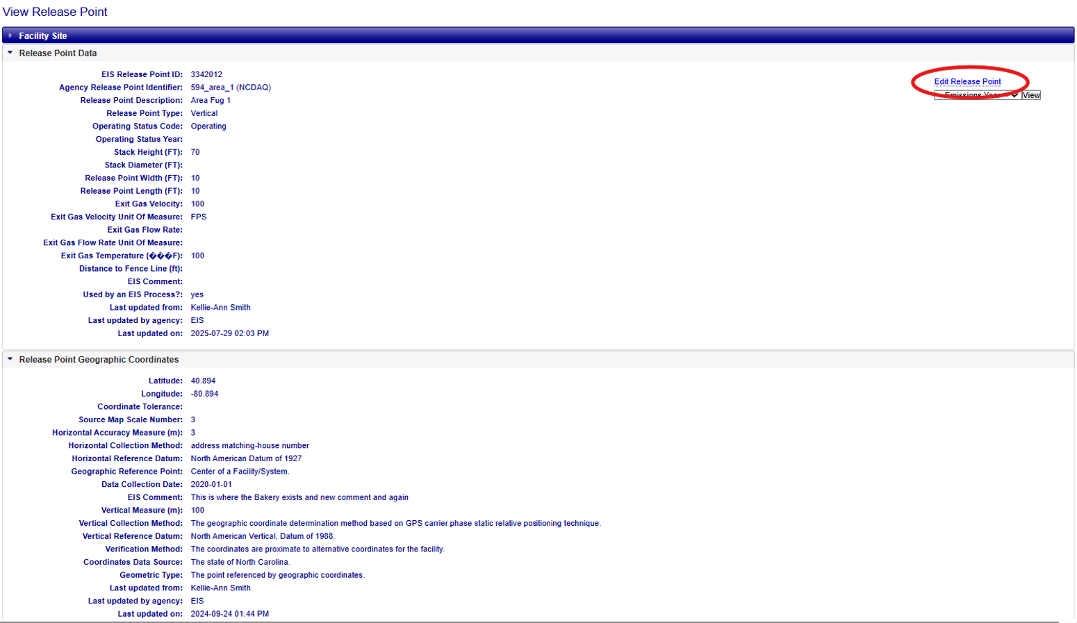
After expanding the Geographic accordion menu within the View Release Point page for a Fugitive or Stack Release Point, you can view the Geographic Coordinates for the Release Point. The fields are the same for all Release Point types, except Fugitive 2D has a separate view to display data for each of the two midpoint coordinates.
Fugitive 3D and Stack Release Points
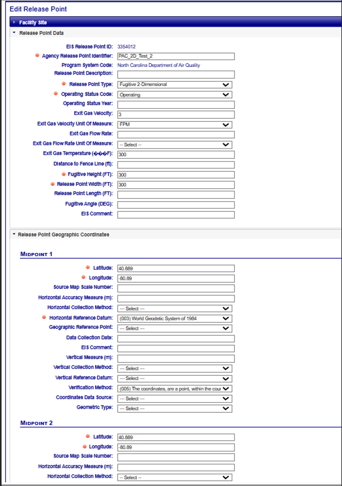
Fugitive 2D Release Points
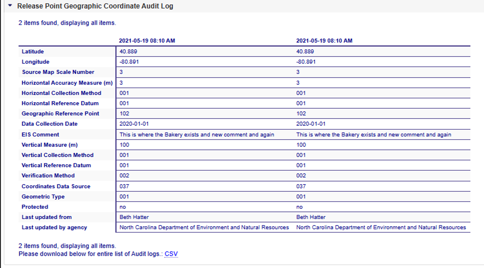
Release Point Geographic Coordinate Audit Log
Provides information about changes that have occurred to the information about the Release Point Geographic Coordinates associated with a release point. It provides time-stamped values of data at the Release Point Geographic Coordinate(s), who made the changes, and the organization that person is associated with. Please refer to the Geographic Coordinate column for descriptions of the fields presented, if needed. A Fugitive 2D Release Point Audit Log will display data for each midpoint.
Fugitive Release Points:
Fugitive 3D Release Point Geographic Audit Log
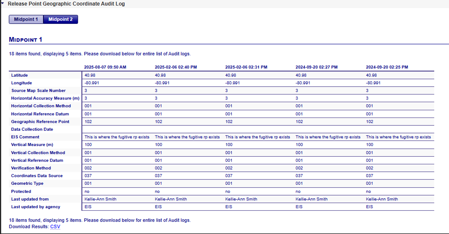
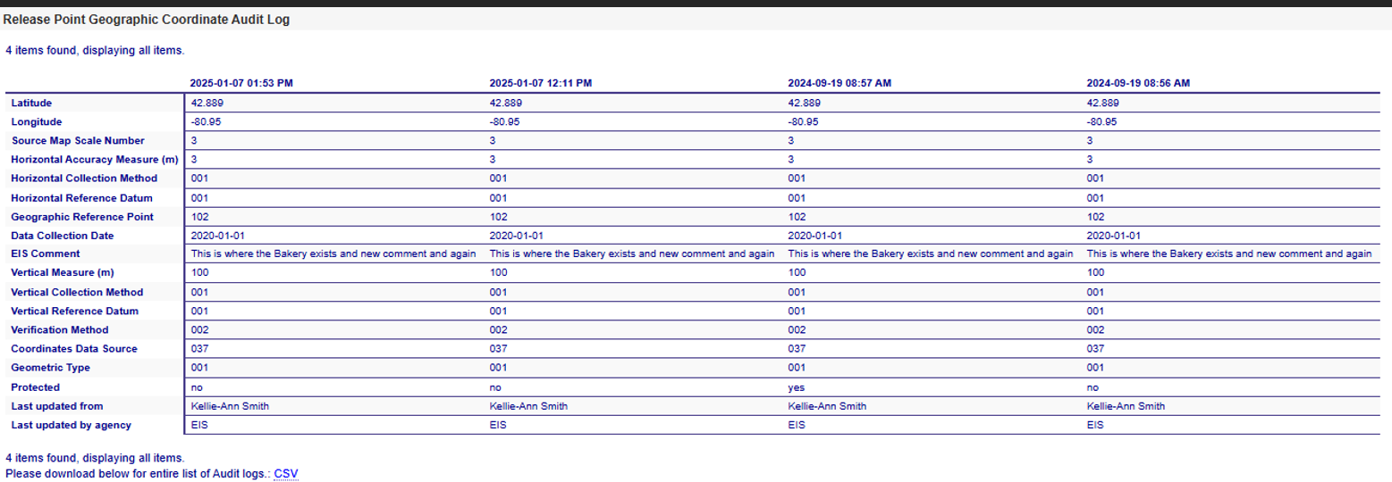
Fugitive 2D Release Point Geographic Audit Log
Toggle between midpoint 1 and midpoint 2 to see each midpoint (note, the lighter blue indicates the midpoint you are viewing and is also displayed under the Midpoint buttons.)
Stack Release Points:
Editing Release Point Geographic Coordinates
If you have been authorized to update information for your agency and the facility inventory window is open, you will see additional links available at the top right corner of the View Release Point page for both Fugitive and Stack Release Points:
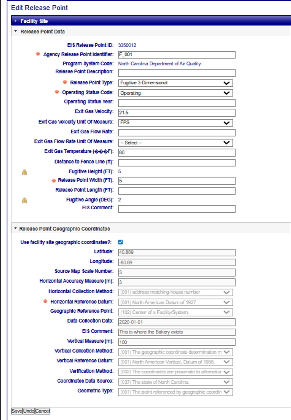
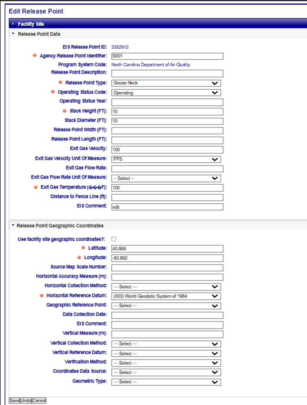
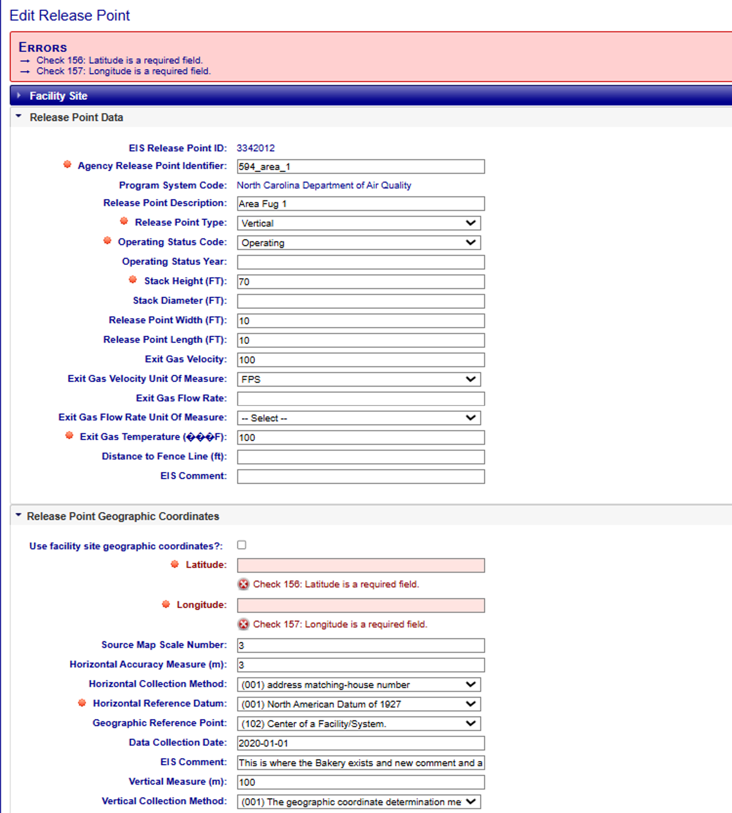
Clicking on the “Edit Release Point” link will open a form that allows you to make changes to the Release Point Geographic Coordinate information at the bottom of the form. Check the “Use the facility site geographic coordinates?” checkbox if your Release Point Geographic Coordinates are not unique and will assume the same coordinates as the facility. The Latitude, Longitude, and Horizontal Reference Datum have a red “starburst” indicator next to them, indicating that they are required fields. You will not be able to successfully save the information in EIS without values populated in these fields. If the Release Point Geographic Coordinate is protected/locked, you will not be able to delete it. Please contact an EPA Inventory Developer if you need assistance with any protected data fields or facility components.
Fugitive 3D
Fugitive 2D
As a reminder, Fugitive 2D Release Point Geographic Coordinates cannot use the facility coordinate for the Release Point coordinates.
Stack
Once all necessary fields have been populated, click on the “Save” button at the bottom of the form. EIS
will evaluate the information provided. If there are any issues, errors will be displayed at the top of
the form. Clicking on the “Undo” button will clear the form of all entries and leave you on the “Edit Release
Point” page. Clicking the “Cancel” button will not save any of the information that you have filled out, and
you will be taken back to the View Release Point that Fugitive or Stack Release Point.
Deleting Release Point Geographic Coordinate Records
Clicking on the “Delete Release Point” link from the View Release Point page will allow you to delete the entire Release Point, which includes the Geographic Coordinates for the Release Point. You will receive a confirmation message asking if you’re sure you want to delete. Clicking OK will delete the Release Point and its Geographic Coordinates and return you to the Facility Site page. Clicking Cancel will not delete the Release Point, and you will remain on the View Release Point. If the Release Point Geographic Coordinate is protected/locked, you will not be able to delete it. Please contact an EPA Inventory Developer if you need assistance with any protected data fields or facility components.