Process Emissions
Nonpoint emissions data consist of EIS components that contain the location, emissions process, reporting period, activity data (calculation parameters), and emissions for each pollutant based upon the activity data. Additional components include optional operating details and supplemental parameter.
The Process Emissions page opens to display the available datasets for the location. Expand the Location and Emissions Process accordions to view additional details about the location and process including the data category and SCC descriptions.
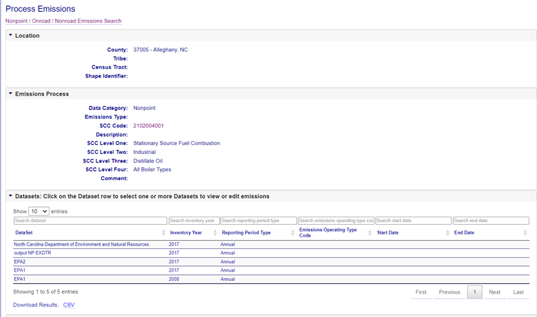
Location
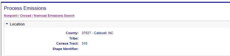
The Location component defines the primary geographic area, as well as the State and County or Tribal land associated with the geographic location of the nonpoint emissions.
- State and County FIPS Code - FIPS Counties codes used for the identification of the Counties and County equivalents of the United States.
- Tribal Code - code that represents the American Indian Tribe or Alaskan Native entity.
- Census Tract Identifier - identifier that represents the post 2000 census tract, which is ideally a neighborhood within a city.
- Shape Identifier - shapefile identifier issued by EPA for a predefined geospatial shape.
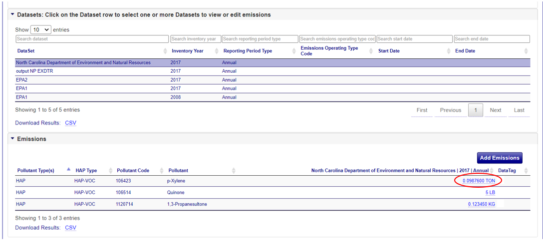
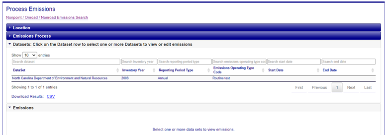
Datasets
Expand the Datasets accordion on the Process Emission page to view a list of datasets associated with the emissions process. Click on one or more dataset rows in within the dataset accordion to select them and display the emissions for that dataset in the emissions accordion.